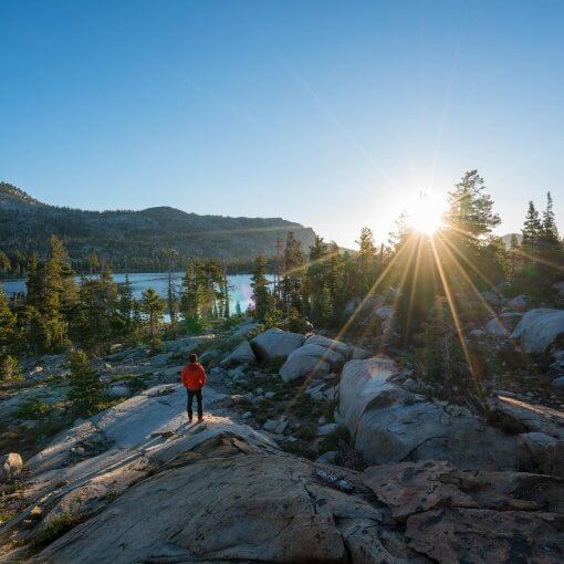
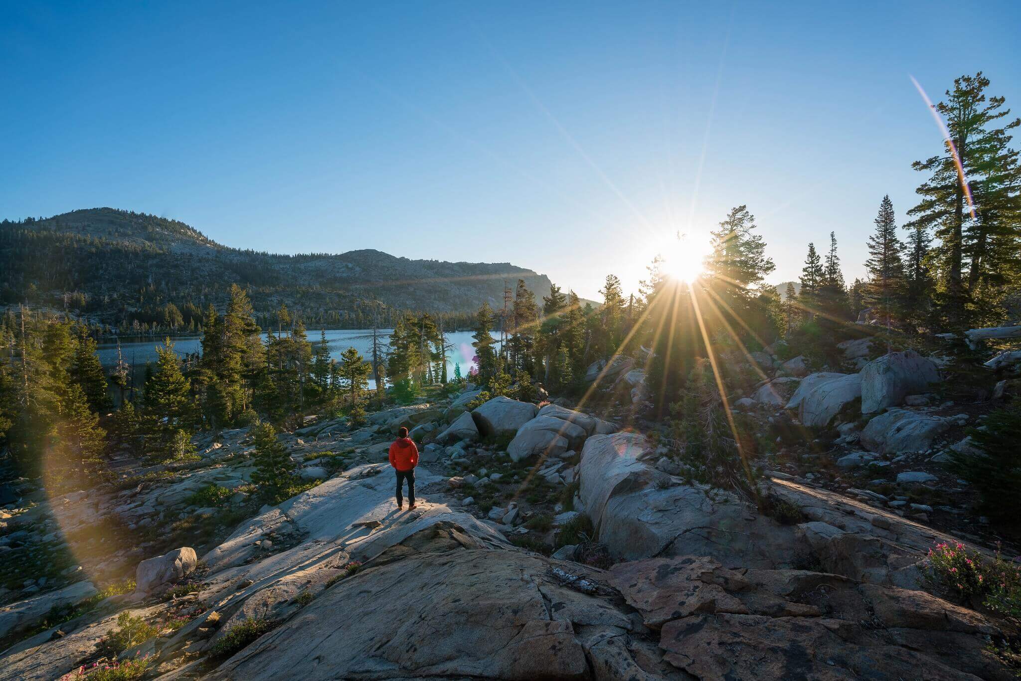
You are probably familiar with the dazzling beauty of California and the various exciting opportunities it offers its inhabitants and visitors. There are beautiful crystal clear lakes, lush green forests and sky-scraping mountains in the region which make for amazing and memorable hiking trips for all those who have an eye for natural majesty. Big Pine Lakes in California is one of many such popular destinations in these parts and gives you a chance to take a peek at the enchanting beauty of the Sierra Nevada Mountains.
Important Facts to Know Before You Go
The Big Pine Lakes trail is one of the most beautiful trails you can ever imagine. It is one of the most popular hiking sites in California and an attraction for many travelers and locals. The trail is well kept for the most part and is not as difficult as the trails you would see in the Six Pack of Peaks challenge. You will need permits to camp without problems and, furthermore, pets are also allowed on this trail. It is best if you plan your adventure between the months of March and October.
Trail Highlights
Trailhead
location: Google Maps
Trail type:
Out-and-Back
Trail Map: Big Pines Lakes Trail
Map
Total distance:
11 miles
Hike time:
6 to 10 hours
Highest elevation:
10,291 feet
Net elevation gain:
3,000 feet
Trail
condition:
Very Well-kept
Preferred season:
March to October
Pets: Yes
Parking pass:
No Parking Fee
Permits:
Not for Hiking, but required for backpacking
Current weather: National Weather
Service
Big Pine Lakes Trail Conditions
The first half of the trail is unshaded by flora and is fully exposed to scorching rays of the sun. It can get really unbearable and tough to hike directly under the sun. Hence, it is recommended that you try to start as early as possible in order to get ahead this uncovered part of the trail before the sun reaches its zenith.
In general, the trail is pretty rocky and steep with a few creeks along the way. The depth and flow of these creeks depend on the weather and the month that you plan your hike in. Moreover, you will not find any phone reception anywhere along the trail as well, so be sure to inform your loved ones beforehand.
How to Get to Big Pines Lakes Trailhead
Take Highway 395 towards the Big Pine town after taking Highway 14 from Los Angeles. Keep going on, before taking a left turn towards Big Pine Creek Road and travel till the road ends while staying straight as it curves right to reach the trailhead. Alternatively, you can also take the Glacier Lodge road to get to the trailhead.
Key Trail Directions and Landmarks
- You will not need a big pine lakes permit for hiking but will definitely require one for big pine lakes camping.
- You will go through a metal gate to start your hike on the main trail.
- The height and flow of the creek greatly depends on the weather and the amount of snow that might have melted.
- It takes a few shaded switchbacks on the trail before you start getting some initial views of the grandeur that lies ahead.
- There is plenty of tree cover along the route and you can always stop on your way back for some pleasant time in the outdoors.
- You will notice some wooden posts blocking a dirt flat on the trail. It means you are on track.
- Be on the lookout for the North Fork and John Muir Signs.
- Take a left from the No Fires sign near Lake 1 to get to its shore.
Start at Big Pine Creek Campsite
Begin at the Campsite and walk along an asphalt road. The road will gradually erode off and you will see the trail pretty clearly from hereon. You will pass through a metal gate to get to the main trail and as you do that you will find the Big Pine Creek flowing gently beside you.
Trail Junction
As you stroll along the creek, you soon reach the North Fork and South Fork junction. Move towards the right to take the North Fork trail. You will start to see some stunning views from here onward and also find some tree shade as well.
On the Wooden Bridge and onto the Sandy Trail
You will have to cross a short wooden bridge to reach the sandy part of the trail. Keep going along the switchbacks while enjoying the wondrous views all around. Hopefully, the greenery will help in dusking down the effects of big pine lakes weather.
John Muir Trail Wilderness
You will cross the John Muir sign to mark your entry in the John Muir Wilderness. The trail converts into a lush green forest and the bubbling creek flows alongside the rocky trail. You will cross Lon Chaney’s Cabin on this route and you will start noticing some glances of the glorious views that lie ahead on the Eastern Sierra.
Lakes Trail Sign
Treading on the trail you will reach a trail sign which will guide you towards all the seven lakes and Black Lake as well. The trail conditions do not usually allow a loop hike and you will have to take left to view three of the seven lakes and make it an out-and-back hike.
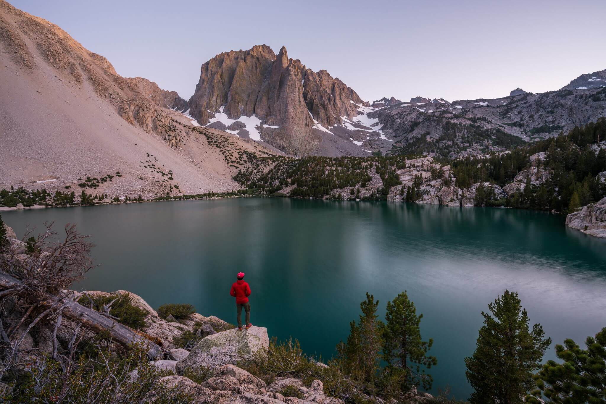
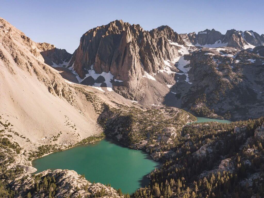
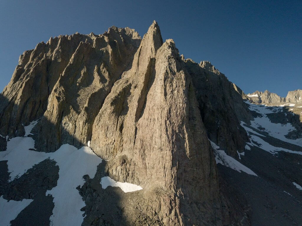
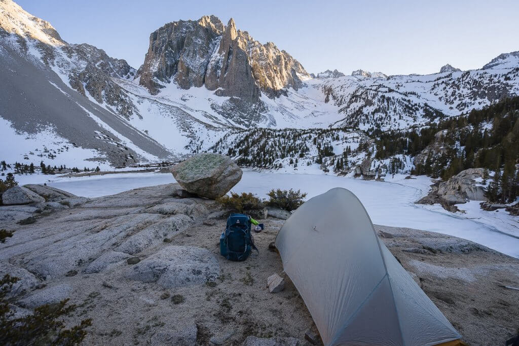
Lake 1 and Temple Crag
If you continue on the trail to the left you will near Big Pine Lakes 1. You will find some dazzling views of the Lake and Temple Crag if you take a bit of elevation by simply going a bit further on the trail.
You can stop at the first of these blue glacial lakes for some rest and for having some much-needed lunch.
Short Hike to Lake 2 and Lake 3
After hiking a short distance from the first lake, you will reach the second lake after treading over some rocky routes. You can choose to carefully go down to the shore of this lake if you want.
It is a very short hike from Lake 2 to Big Pine Lake 3, they are just 0.4 miles apart.
The Way Back
The trail back is very easy. You will have to just trace back the way you came and follow along.