“Life is either a daring adventure or nothing at all.” – Helen Keller

Table of Content
Do you already know what you’re looking for and just want to directly get to that topic? I get it. The links below will help you.
- Permits
- Maps
- Backpacking Checklist
- Food and Nutrition
The Trip
About two years ago, on November 10-13th 2017, I planned a backpacking trip to Havasupai with my group of adventurous friends who have been wanting to go. After doing extensive research, this is the itinerary I’ve put together. Hopefully this will help others in planning such a trip.
Day 1
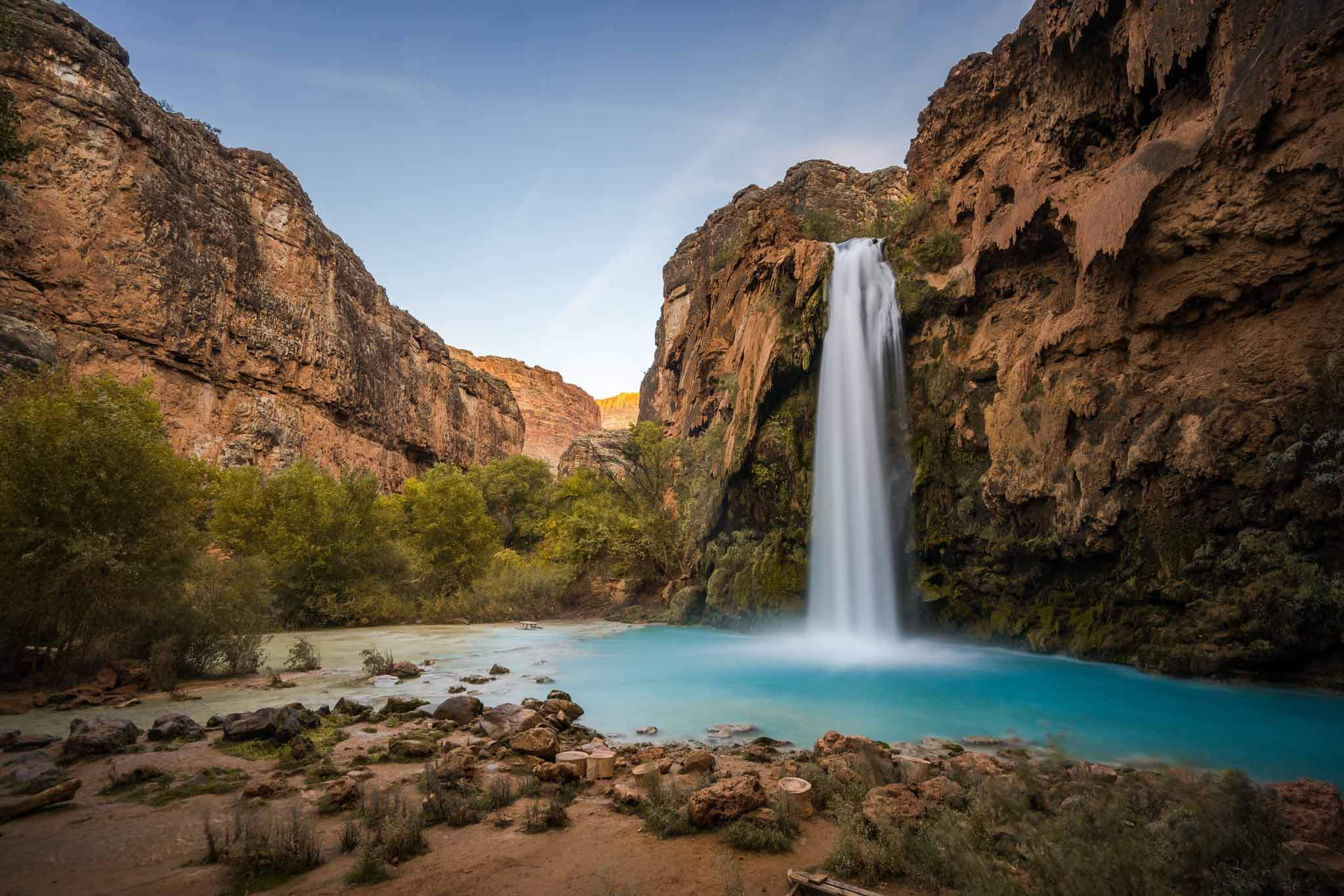
A long weekend in the rugged yet beautiful paradise of Havasupai. The hike will start at the Hualapai parking lot and will pass through red canyons, blue streams, desert terrain, the Supai village, FiftyFoot Falls, Navajo Falls, and Havasu Falls before arriving at our campground on the first day.
Day 2
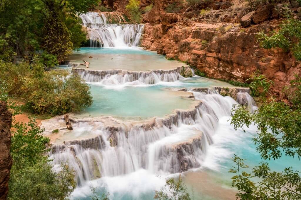
The second day will be action packed with a day hike to Mooney Falls and Beaver Falls, where we’ll get a chance to swim in the turquoise blue waters.
Day 3
We will be ending the trip on day 3 by hiking back into the Supai village to fill up on water and get last minute photos and soak in some memories. Moreover, we’ll have the option to helicopter out from here, depending on operation days and times.
Trip Highlights: Location, Permits, Distance, Elevation and More
Trailhead location: (36.159735, -112.709318)
Trail type: Out and back
Total distance: 27.5 miles approx
Total hike time: 8 Hours to Supai
Difficulty: Hard
Elevation Grade: 5%
Net elevation gain: 4,690 feet
Trail condition: Well maintained
Preferred seasons: June to November
Pets: Not allowed
Parking:
Hualapai Hilltop Parking Lot
Permits: Paid Permit
Park contact: The Official Havasupai Tribe
Current weather: National Weather Service
Trail and Weather Conditions
It is an out and back type of trail that is well maintained, sandy, and dry. Furthermore, the trail is mainly exposed to the sun with a few trees here and there. However, there will be 5-7 stream crossings on the trail from Mooney Falls to Beaver Falls.
We’ll need chew proof containers/bags since there will be small mammals there lurking through the night. In addition, expect temperatures to be in the low 30s and highs in the mid 75s. It’s basically desert-like weather, with freezing cold (30F) temps until the sun comes out. As a result, winds can be up around 10-15mph. There’s always a flash flood alert since we’ll be in a canyon.
For the most updated weather report, click HERE.
Trail Distance Breakdown
Hualapai (trailhead) to Supai (village) = 8 mi (total: 8 miles, 2200’ elev. loss)
Supai to Campground = 2 miles (total: 10 miles, 200’ elev. loss)
Campground to Mooney Falls = 1 miles (total: 11 miles)
Campground to Beaver Falls = 2.75 miles (total: 13.75 miles)
Permits & Reservations
Permits are required for overnight camping in Havasupai. Hence, we will pick up the permits/check in after a 8 mile hike into the Supai village. Our campsite will be #17 with 16 total members. For more information on permits, visit Havasupai Reservations.
Maps
Below are maps I’ve found useful for this trip. You can download the GPX file of the trail HERE
Note: With Wifi, please download the offline map of this area through your google maps app.
Day 1 Itinerary
Distance: 10 miles. Elevation: 5,175 feet to 2,901 feet Sunrise: 704AM Sunset: 525PM ETA: 8 HOURS
Trip: Hualapai Parking Lot >> Supai Village >> Fifty Foot Falls >> Navajo Falls >> Havasu Falls >> Supai Campground
We will all rendezvous and caravan to Hualapai parking lot. Therefore, it will take us roughly 7 – 7.5 hours to drive there from Los Angeles.
Our goal is to start the hike as early as possible, ideally before the sun rises. It is 8 miles from the trailhead to Supai Village. Hence, this should take about 5 hours.
At the village we’ll receive our bracelets, take bathroom breaks etc. Then we’ll hike 2 miles to campsite #17. This should take about 2 hours. The goal is to start hiking by 6am and reach the campsite by 2:30pm.
Click here for Google Maps Directions to Hualapai Parking Lot
Day 1 Key Things to Note:
- Fill up gas, water, and optional food before parking lot. The last spot before the parking lot is at Peach Springs and Seligman.
- No water source from the beginning of the trail until we get to the Supai Village which is 8 miles in.
- After the 1st mile from trailhead, we will have descended 2000 feet.
- Going into the campground, we’ll arrive at the top of Havasu Falls and descend on the left side.
- There’s 1 water faucet along the west wall of the canyon.
- There are toilets close by. They have toilet paper but bring some just in case.
- We have the option to stop by Fifty Foot waterfall on the way to the campground.
Day 2 Itinerary
Distance: 7.5 miles RT. Elevation: 2,901 feet – 2,501 feet ETA: 3 Hours to Beaver Falls
Trip: Supai Campground >> Mooney Falls (1mile) >> Beaver Falls (2.75miles)
Start time: 7:00am Sunrise: 7:05AM Sunset: 5:24PM Optimal Sun Time at Beaver Falls: 1030AM – 11:45AM
We will start our day hike early in order to avoid the crowd and to catch the sun perfectly to swim at beaver falls. Moreover, remember to pack light with plenty of electrolytes, snacks, dry towels, and your water shoes. Bathing suit/trunks optional. Gloves are optional since the chains at Mooney falls will be wet from the fall’s spray.
Stop and Explore at Mooney Falls
Stop and explore the pools around Mooney, and head back towards the path we came down on to find the trail to Beaver Falls. The trail hugs the western wall of the canyon and heads northwest from there.
The trail will soon lead us down to Havasu Creek, where we’ll meet our first water crossing of the trip. There are wobbly narrow bridges at the first crossing if we want to stay dry for this portion. Once across, climb up the bank and keep heading northwest. After continuing on for a short while, we’ll come to our second water crossing – we can’t avoid getting our feet wet at this one!
After the second water crossing, we’ll wander through some incredible open areas of the canyon, overgrown with wild grape, and pass a lot of prickly pear and barrel cactus. Continuing on, we’ll notice around the bend – a date palm tree.
At the Date Palm Tree
Once we get to this tree we’ll have two options to get to Beaver – we can cross the creek again to a trail that will lead us along (and sometimes through) the creek to the upper falls at Beaver, or we can take a sharp right up the wall and climb up higher on the bank towards Beaver.
If we take this route, turn left when we see the sign for the falls and hike down a network of ladders to the lower section the falls. Be mindful of false trails here and look for the picnic table and lower ladders below to help guide us. Once we’ve arrived at Beaver it’s time for a swim!
Day 2 Key Things to Note:
- A short 1 mile hike to Mooney Falls. We will go down to the base of the waterfall. Fairly treacherous and slippery. Make sure your water shoes are grippy.
- From Mooney falls, we’ll hike ~2.75 miles to Beaver falls. Stay right on trail forks there, keeping river on your right side. You’ll arrive on the right side of river with river on your left side.
- Remember to bring water filters to filter water from waterfall and creeks along the way, throughout the day.
- Remember dry bags for electronics, sunscreen and possibly hat.
- There’s 1 water faucet along the west wall of the canyon.
- Stream crossings 5 times minimum. Water level as high as waist for 5’ 3” individual. Water flow medium.
Day 3 Itinerary
Distance: 10 miles. Elevation: 2,901 feet – 5,175 feet ETA: 8 Hours
Sunrise: 7:06AM Sunset: 5:24PM
Trip: Supai Campground >> Supai Village >> Hualapai Parking Lot
Start time: 5:00am Be at Helipad: 6:00am
Wake up in the morning to a sunrise over Havasu Falls. Helicopter back to parking lot is optional. If helicopter is flying, start hike to helipad in village by 5:15am. If not, we’re all hiking back. We’ll drive back home, stopping for food and bathroom breaks as needed
Day 3 Key Things to Note:
- Fill up water, and optional snacks at campsite and supai village. We have 8 miles to parking lot from Supai Village. Please bring extra water to leave in car when we hike back.
- Bring pen and cash for helicopter ride.
- It is $125/person for the helicopter ride.
- The hike back is 2 miles uphill/stairmasters style all the way to the village.


